Map heights.tga
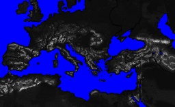
The map_heights.tga is the tga that controls both the coastline and the heights displayed on the campaign map.

Fig1. Reduced version of the vanilla RTR map_heights.tga
The blue areas represent the sea areas - these areas will be water in the campaign map regardless of any different areas marked as sea in map_regions.tga and map_ground_types.tga. If there is any discrepancy between these files the sea area shown in map_heights.tga is always used. The game applies a default ground or water type to any mismatched areas in map_ground_types and extends or contracts the regions shown in map_regions to fit. In RTW and BI (not M2TW) a corrected_regions.tga is generated and placed in the Rome - Total War folder each time a campaign is started, the corrected_regions.tga shows the adjustment the game has made to make the map_regions.tga fit the map_heights.