Map climates.tga
Contents
Overview
The map_climates.tga is the map tga that controls both the type of texture used for each ground_type displayed on the campaign map and also controls various elements of the battle map.
Map_climates.tga will be found in the data/world/maps/base folder of a vanilla installation, it may also be placed in the data/world/maps/campaign/campaign_name folder if the other map files are copied there as well.
Certain climates are hardcoded to have a snow effect in winter, whilst others do not. This can be changed visually by altering descr_aerial_map_ground_types.txt references, but the game will still associate 'snow' movement and unit penalties/bonuses with that climate in winter.
The climate used also determines the type of tree displayed on both the campaign and battle maps.
Illustrations of Vanilla Campaign Map Textures
Note: All of the images in this section currently are from Medieval II: Total War
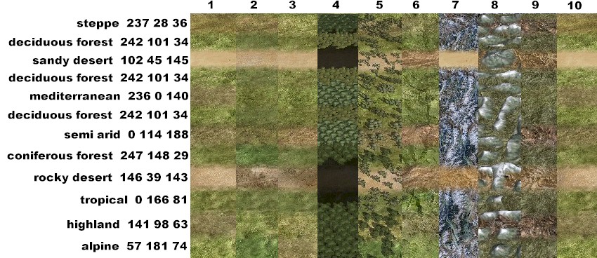
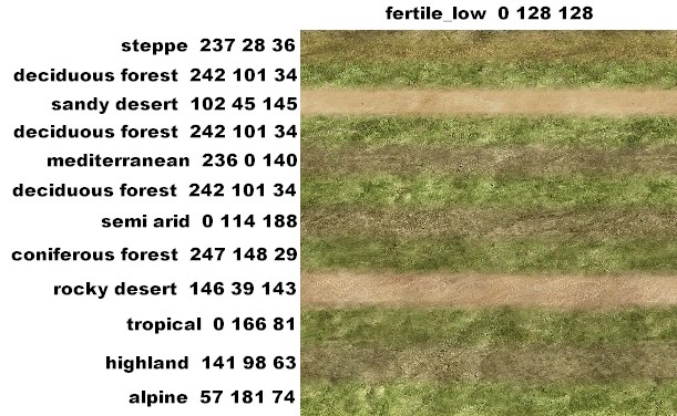
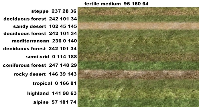
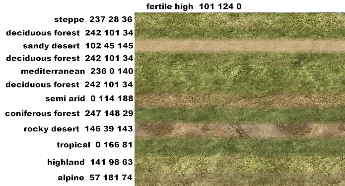
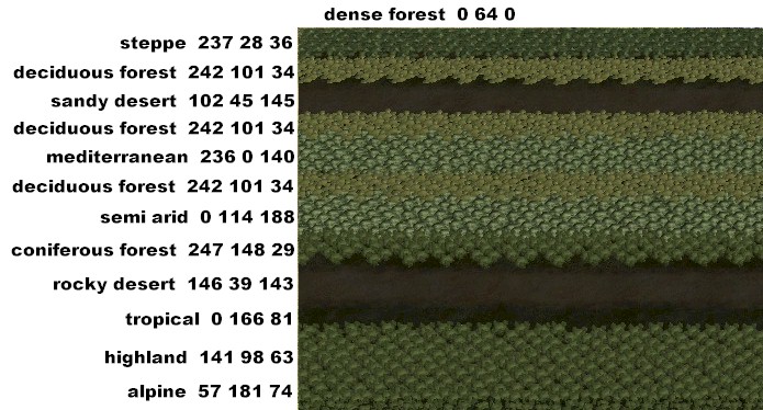
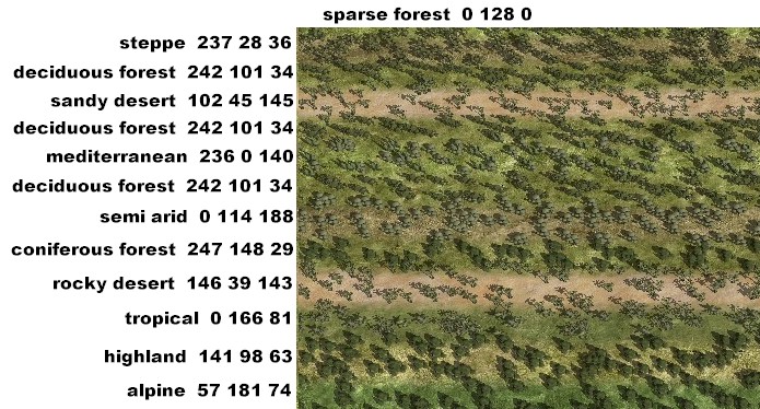
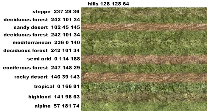
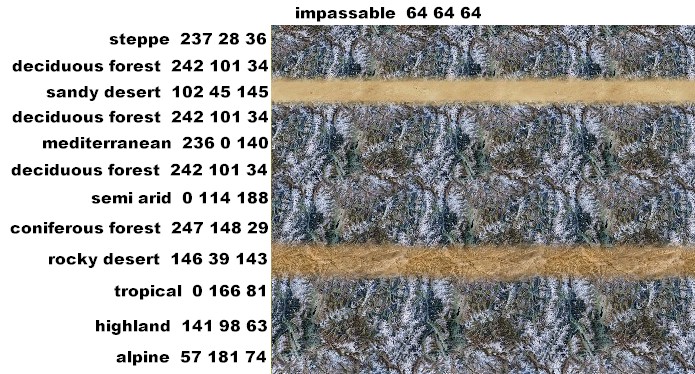
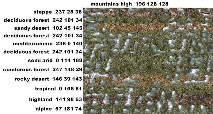
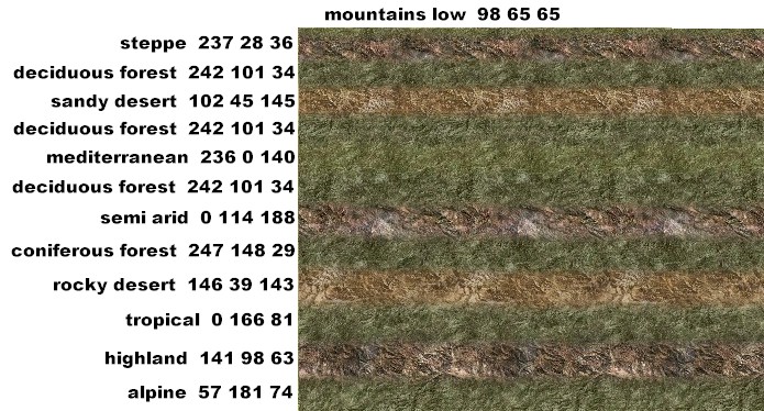
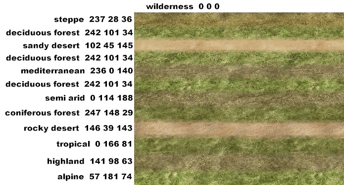
The following images were supplied to illustrate the effects available by editing map_climates.tga with the vanilla texture files. The actual texture that is used is determined by the combination of climate and ground_type, which calls the tga referenced in descr_aerial_map_ground_types.txt.
There are several images, one with each type/climate laid out side by side then a larger image of each ground_type with a strip of climate through it.
Key to Ground Types:
- 1. low fertile
- 2. medium fertile
- 3. high fertile
- 4. dense forest
- 5. sparse forest
- 6. hills
- 7. impassable (note not available in RTW)
- 8. mountains high
- 9. mountains low
- 10. wilderness
In the vanilla game swamp and beach always look the same no matter what climate is used. Impassable has a few different looks but not many. The pictures that follow separate the climate types so they are easier to see, and insert deciduous forest a couple of different times for a line break.
- The pictures below were supplied by GrnEyedDvl:
Adding Variation to the Textures Displayed
The textures displayed on the campaign map (see above illustrations) can be varied by changing the textures referenced in descr_aerial_map_ground_types.txt. In the vanilla game many combinations of climate and ground_type reference the same texture .tga, if additional tga's are available they can be added for selected combinations to enhance variety.
Effect of Climates on Battle Map
The climate defined by this file for a particular location on the campaign map controls a variety of effects on the battle map. This includes the weather and cloud effects that are controlled from Descr_daytypes.txt, these are set by climate and by season. The weather effects change both the appearance of the battle-field and lighting and the effectiveness of battle play. Visibility can be severely affected by weather. Typically desert areas are prone to dust storms and northern areas prone to blizzards.
The textures used for the battle map ground surface are also determined by climate.
The weather conditions in the Descr_daytypes.txt file also reference sound files, so ambient sounds can also be varied by climate.
